


Call for Sites Map
8th October 2026
The link below provides access to Maidstone Borough Council’s Call for Sites interactive map, which displays all land parcels submitted for consideration as part of the emerging Local Plan Review. The total quantum of land put forward across the borough significantly exceeds MBC’s identified requirement, and it is therefore expected that only a proportion of these sites will progress to the next stage of assessment.
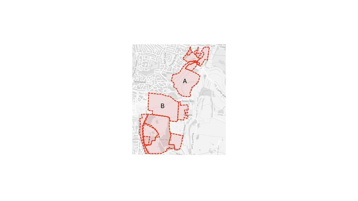
However, upon examining the map in detail, Downswood Parish Council has noted with concern that the agricultural field immediately to the rear of Mallards Play Park has been formally submitted through the Call for Sites process.
On the map, Site A corresponds to this field, while Site B denotes the field opposite St Nicholas Church. Although both parcels lie within the civil parish of Otham, their development would have direct and material consequences for the residents of Downswood as well as Bearsted.
In light of this, Downswood Parish Council is preparing a formal communication to the MBC Planning Department, approved at our recent council meeting, requesting that these parcels not be advanced for inclusion within the new Local Plan. While there is no statutory requirement to make representations at this early stage, the Council considers it both prudent and necessary to set out its position now, particularly given the sensitivities of the local landscape and the cumulative pressures already experienced by our community.
Any submission made by the Council must be robust, evidence‑based, and aligned with the new National Development Management Policies (NDMPs), which are due to be introduced by the Government at the end of this month. These policies will form a key part of the national planning framework and will therefore underpin the assessment of all future site allocations.
Letter sent to MBC can be viewed here statement_of_intent298.docx
Maidstone Borough Council - Map


.jpg)


